
As you travel north from Southern California along highway 395, you come across some of the most spectacular views on the entire planet.
The trip began at 5:00am. As I left my home it was pitch black, but that soon changed as the sun came up.

I was headed north on the 14 when the sun began to light up the night sky and ultimately emerge from behind the El Paso Mountains. Peaking through the clouds, the golden sunset on the Mojave started my trip on a high note.

The view from the Visitor Center of the eastern edge of Sequoia National Park.
From there, I connected to the 395 northbound and made my first stop in Lone Pine at the Eastern Sierra Interagency Visitor Center. No matter how well prepared you are, these visitor centers can provide invaluable information, current weather conditions and advice which you may not have had access to otherwise. They even recommended where I can get the least expensive gas, to fuel up… FYI, it was in Independence City.

As I stopped off at Independence, I couldn’t help but to go off-road, toward the mountain range, near the Historic Site of Manzanar. This is part of our country’s dark period, where we kept Japanese Americans in interment camps.


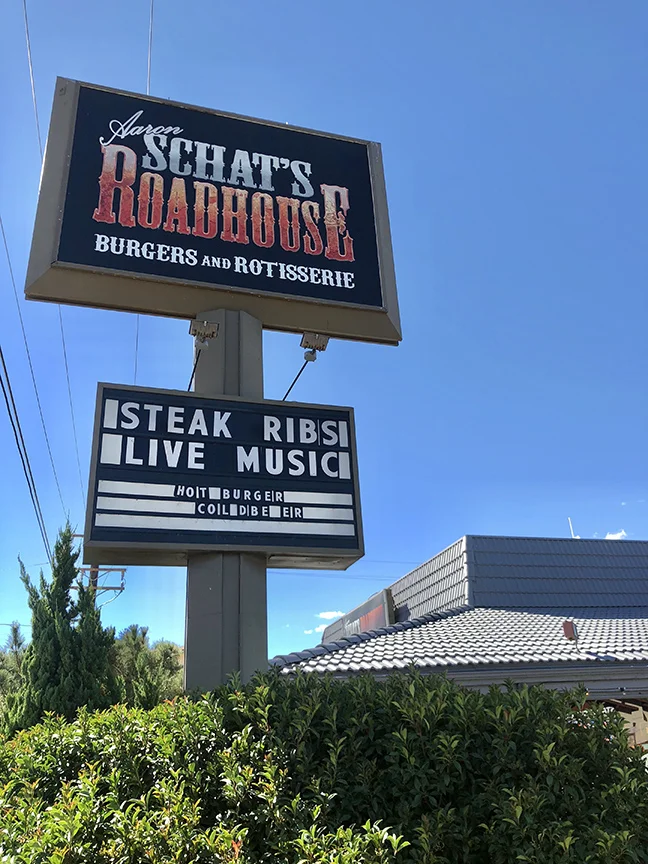
From there, I proceeded onto Bishop to grab a bite to eat. I was drawn to Aaron Schat’s Roadhouse, where I sat in my preferred “paranoid” seat and ordered the Walker Texas Ranger burger with sweet potato fries. It was awesome, I highly recommend it to anyone going through.

From Bishop, it was a straight shot to the June Lake Loop, where the views really blew me away.

June Lake, CA
Just south of June lake was the smaller Gull Lake, which I actually enjoyed more. It’s proximity to the mountain range to the south made for more majestic views, especially when you go on small treks away from the crowds.

Gull Lake

I love how the sun lights up the fishing lines here.
It’s easy to see why the striking beauty of the Eastern Sierras are dubbed “The Switzerland of California”.

The June Lake Loop is full of twists and turns, one more picturesque than the other. With the Autumn leaves lighting up the road, you can’t help but stop to take in the scenery.

Hiking along Silver Lake puts you in another world.

As I prepared to capture my image of Silver Lake, Daffy came by for a classic photo bomb.
After completing the June Lake Loop, I went back to Gull Lake to set up for my astrophotography. The expedition was planned to coincide with the new moon, to assure the least amount of light pollution and to capture some breathtaking shots of the Milky Way.
It was while I was setting up and testing out the timing for my astrophotography, when it happened!


The Space X rocket launch took place, right in my frame. I had no idea they were launching, and truth be told, it did kind of freak me out, as this strange ominous light appeared from the darkness.
Later, I of course found out that it was just a rocket launch and not an alien invasion, so that was a relief.
Once the smoke cleared, I was able to capture the image of the Milky Way, I set out to capture.

Now, because this was shot in October, the majority of the meaty portion of the milky was had already dipped below the horizon, as the sun set and the stars came out. The yellowish/orangish part which you’re seeing is the top tip of the milky way. By December, you won’t even see any of that. It won’t be until March of next year until you begin to see it again, and the best time to shoot the night sky would be in July.
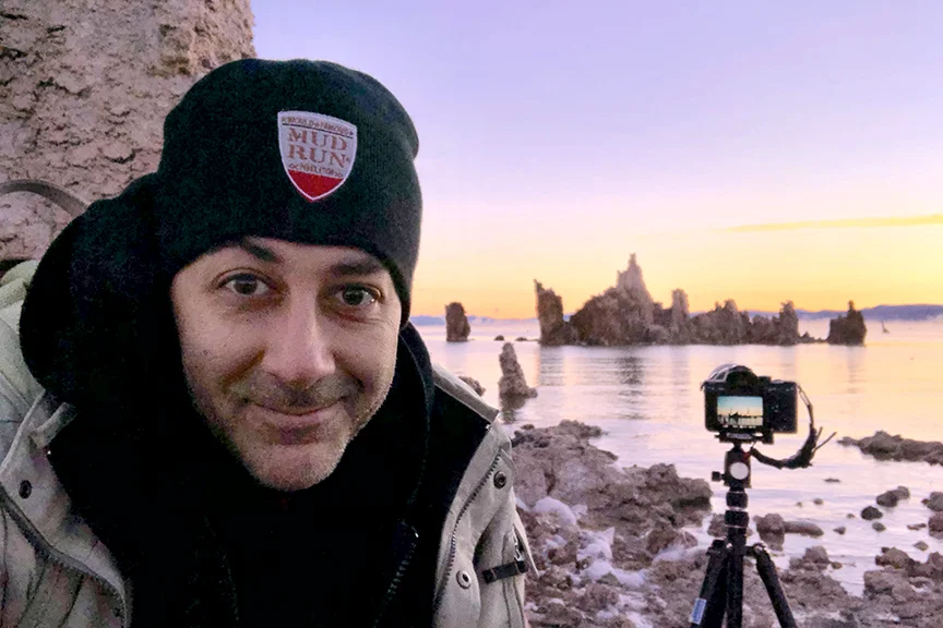
The following morning, it was another early start as I had to get to Mono lake prior to the sunrise. Once there, I found a few other photographers, committed to getting the sun rise over the tufas. By the time the sun came up, there were a good 10-15 photographers, all competing over the best spot. Luckily, I had arrived early enough to secure my prime location.
As the stars fade away the dark sky turns deep purple and eventually lavender and orange. You notice the sun rays hit the bottom of the clouds, similar to what you may see during a sunset. However, the early morning hours prove to be calm, quite and blisteringly cold.

I loved noticing the fog over the lake behind the tufas.
Once I knew I had my shot, I noticed a handful of photographers behind me trying to get a similar shot, so I decided to switch my position in an effort to get a different perspective.

The sun rays hitting the eastern edge of the tufas, lighting up the fog on the water, was enough to make this my favorite capture at Mono Lake... but then came that Osprey, who flew across my frame and was the cherry on top!
After that, I walked around, looking for other viewpoints of the tufas, and honestly, at this point, there were about 30 photographers roaming around, so it was harder to get a clean shot without people.

I did manage to get this quintessential shot of the tufas reflected in the water, but because it was windy, the water was moving. Had it been a completely still morning, that reflection would’ve been like a mirror. Maybe on my next trip.

From Mono Lake, it was breakfast at Nicely’s Restaurant in Lee Vining. Then I refueled and headed out west on the Tioga Pass Rd, highway 120, towards Tuolumne Meadows and Yosemite.

More of the extraordinary colors of the changing seasons.

Cathedral Peaks welcoming me to Yosemite Valley

Tuolumne Meadows

Cathedral Peaks, from Tuolumne Meadows.

Hiking along the Merced River with Cathedral Rocks in the background.

Bridalveil Fall.

El Capitan! From this angle, I see the left profile of an elephant. Anyone else see it?

The Royal Arches and Half Dome, as I hike through a meadow.

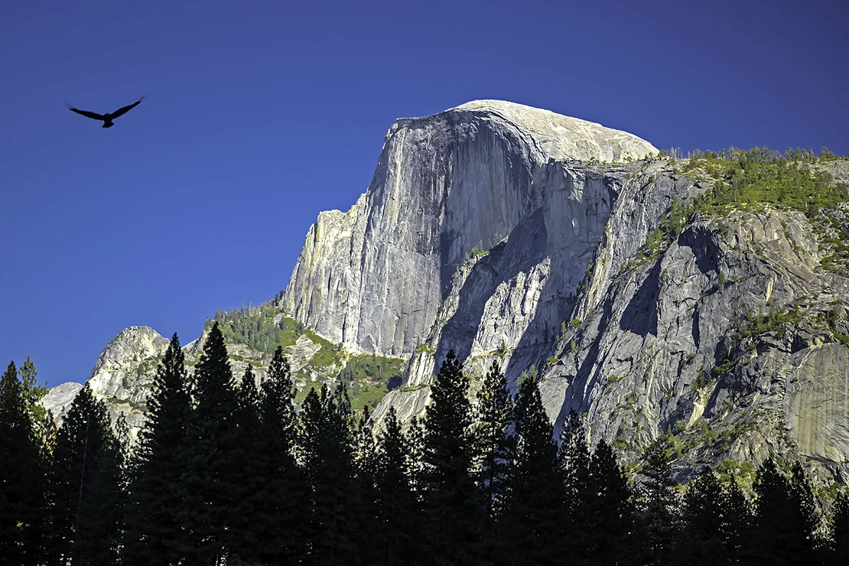
Half Dome, which is arguably the quintessential landmark for Yosemite, with a tree line silhouetted by the mountains behind me and a hawk flying above. Just like my image of Mono Lake, it is the wildlife, which appears unexpectedly that completes my image.

This is a 14 image panoramic, stitched together of this awe-inspiring spot, the tunnel view of Yosemite Valley.
I can only imagine what it must’ve felt like for the native Americans, the Miwok tribe and the Ahwahnechee people, to have first laid eyes on this vision.
It’s hard to believe that Yosemite Valley and the Eastern Sierras are only a 5 or 6 hour drive from Los Angeles. Once you go in, you feel transformed to another world, where every view you see is more stunning than the one prior to it. It is quite overwhelming and I eagerly await my next trip out here, to further explore the peaks and valleys, rivers and lakes that this land has to offer.